SMEM
Soil Moisture Ensemble Method
Monitoring soil moisture and vegetation water content from space
using advanced Earth Observation technologies
The Project
The Soil Moisture Ensemble Method (SMEM) is an ESA-funded initiative aimed at improving the accuracy and spatial resolution of soil moisture and vegetation water content retrievals using multi-frequency satellite radar data.
The project addresses key challenges in complex environments such as mountainous terrain, dense vegetation and arid regions.
Duration: 2 years (starting September 2025)
The SMEM Concept
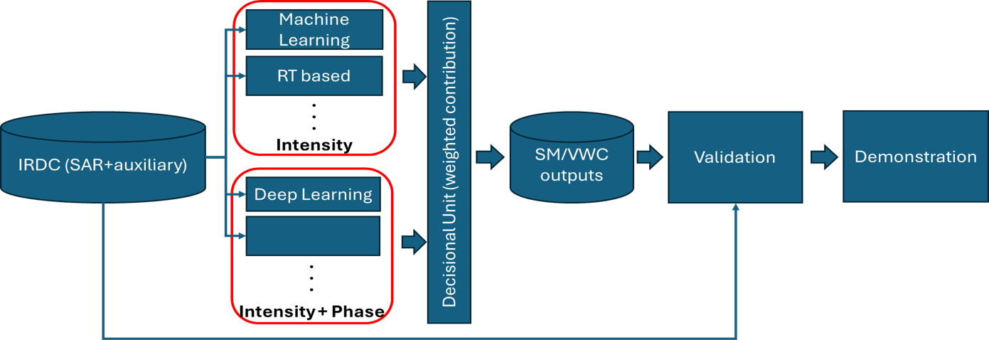
SMEM introduces an ensemble approach combining multiple data sources and algorithms to improve robustness and reliability of the retrievals.
- Multi-frequency SAR (C-band + L-band)
- Artificial Intelligence and Deep Learning
- Physically-based modelling
- Multi-sensor integration
Scientific Objectives
Enhance Retrieval Accuracy
Improve spatial resolution and reliability of SM and VWC products.
Improve spatial resolution and reliability of SM and VWC products.
Exploit Multi-Frequency Synergy
Combine C-band and L-band SAR observations for improved sensitivity.
Combine C-band and L-band SAR observations for improved sensitivity.
Advance EO Techniques
Develop innovative algorithms integrating AI and physical modelling.
Develop innovative algorithms integrating AI and physical modelling.
Support Future Missions
Define roadmap and identify challenges for next-generation systems.
Define roadmap and identify challenges for next-generation systems.
The Consortium
- CNR-IFAC – Coordinator
- EURAC Research
- DLR – German Aerospace Center
- TU Wien
- University of Modena and Reggio Emilia